The Commercial UAV Expo 2022 is set to take off at Caesars Forum, Las Vegas, on September 6 to September 8.
The Droning Company will be there in force, of course, reporting on all the news, events, debuts, demos, and more. We'll continue to post stories on the Expo from right now until the last pilot leaves the Forum. Stay tuned.
For now, we thought you'd like to know about the fabulous workshops and training sessions scheduled at the big show...
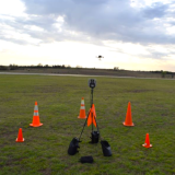
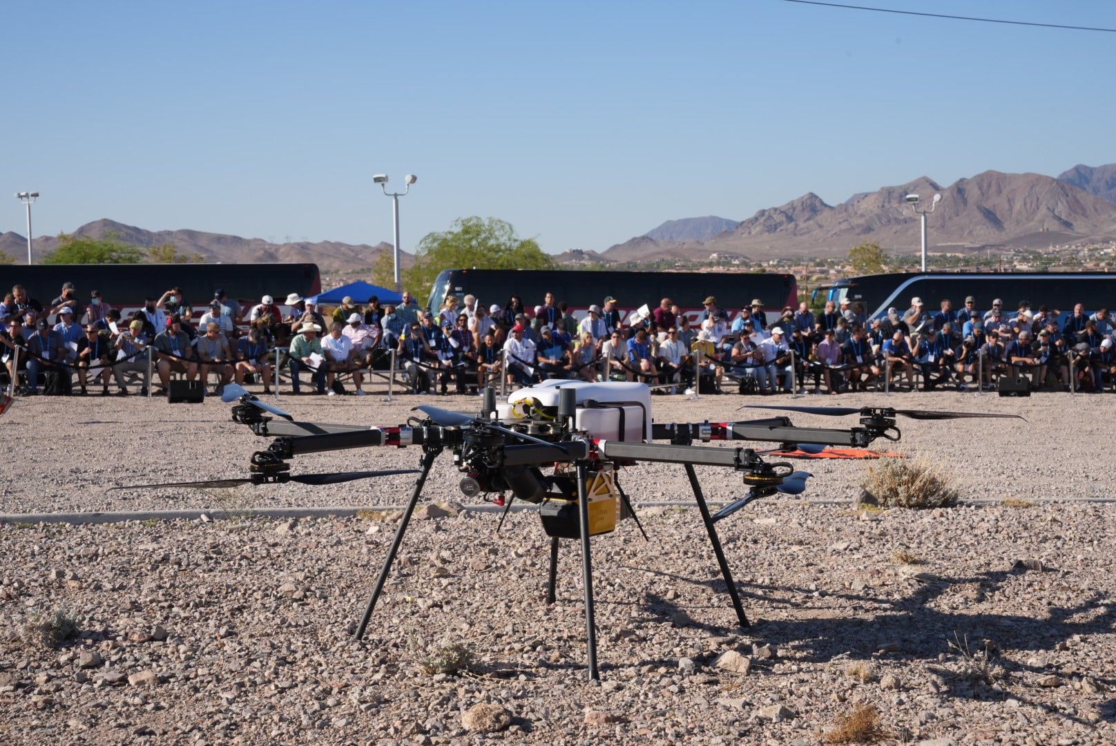
LIVE OUTDOOR FLYING DEMONSTRATIONS
September 6, 2022 • 7:00 AM - 1:00 PM • Off-Site Location
Organization and support provided by Sundance Media Group. Slated to appear:
Autel Robotics USA
Wingtra .
Commaris
Frontier Precision
Skydio .
Skyfront Corp.
Volatus Aerospace Corp.
Decisions Made Easy: Drone LIDAR + Photogrammetry Mapping
September 6, 2022 • 8:00 AM - Two Sessions Available: 11:00 AM and 1:00 PM - 4:00 PM
Planning to acquire a drone LiDAR system and wondering what to do next? You are not alone; it’s a big decision and requires a combination of hardware, software, training, and support. GeoCue’s TrueView 3D Imaging Sensors (3DIS) have provided a technical advantage for several years now, and our team can help make your decision-making process a bit easier. Learn how to use TrueView to generate highly accurate true 3D colorized point clouds and inspection imagery from a single UAV flight. We will also explore GeoCue’s robust and fully integrated software suite, LP360. Even if you already own a LIDAR system, our LP360 software discussion will show you how to streamline your client projects, from analyzing data to generating final products and compiling reports. Our team will show you what to look for to select the right equipment and software to successfully complete your geospatial projects. Participants will take away a better understanding of how to identify which products fit their needs based on application and project specifications. Additional registration required – $95 Registration fee (each session).
Photogrammetric Mapping with UAS
September 6, 2022 • 8:00 AM - 12:00 PM
This workshop teaches the fundamentals of creating controlled map products and 3D models from UAS-mounted camera systems. Participants will learn to successfully design projects in accordance with ASPRS Positional Accuracy Standards, including flight planning, ground control placement, camera calibration, block adjustment, product generation, quality control, and accuracy assessment. These concepts will be taught with a software-agnostic approach that is applicable to any commercially available package. Topics covered in this workshop are representative of those included on the ASPRS Certified Technologist and Certified Mapping Scientist examinations. Cost: $275.
The Complete Workflow Made Easy for Any Drone Projects
September 6, 2022 • Two Sessions Available: 10:00 AM - 12:45 PM and 2:00 PM - 4:45 PM
Skyline Software and AirWise Solutions will be hosting a workshop to discuss and educate how to utilize Drones, Aerial Imagery, and Photogrammetry to produce 2 and 3D products for a broad range of real-world applications. Including construction, public safety, change management, urban planning, and mapping. Signing up gains you access to all 3of our segments in the workshop. Each segment will be run twice, once in the morning and then in the afternoon to accommodate schedules. Joining our workshops will educate both advanced and new users to the industry with a variety of speakers and end-users solving real problems.
Lidar Mapping with UAS
September 6, 2022 • 1:00 PM - 5:00 PM
This workshop teaches the fundamentals of creating controlled map products and 3D models from UAS-mounted lidar systems. Participants will learn to successfully design projects in accordance with ASPRS Positional Accuracy Standards, including flight planning, ground control placement, lidar system calibration, point cloud processing, product generation, quality control, and accuracy assessment. These concepts will be taught with a software-agnostic approach that is applicable to any commercially available package. Topics covered in this workshop are representative of those included on the ASPRS Certified Technologist and Certified Mapping Scientist examinations. Cost: $275.
End-To-End Workflow for DJI Zenmuse L1
September 7, 2022 • 9:00 AM - 4:00 PM
The DJI Zenmuse L1 is gaining a reputation among surveyors as being a great balance between capability and affordability. This hands-on workshop will teach you everything you will need to know to go from no drone LiDAR experience to creating accurate and verified survey deliverables using the DJI Zenmuse L1. We will show you:
• How to flight plan missions for different operational scenarios• How to execute different survey approaches (RTK, PPK)• How to post process and calibrate using DJI Terra• How to install and navigate TerraSolid UAV• How to validate your LiDAR using ground control and validation points and export control reports• How to setup and modify your automatic point classification macro• How to perform manual ground classification, breakline extraction, and surface generation• How to export your survey deliverables for MicroStation and AutoCADBAAM Tech will provide free temporary licenses for all the software you will need as well as processing datasets you can take with you after the training. This training will provide you with hands on experience with the hardware and software you need to know in order to execute successful, accurate, and profitable drone LiDAR projects. Cost: $150.
Night UAV CSI Demonstration
September 7, 2022 • 7:30 PM - 9:00 PM
Sundance Media Group, and public safety personnel will demonstrate how to achieve scene capture in the dark, with a drone, capable of 2D and 3D mapping and modelling. These same techniques may be applied to virtually any type of night scene capture. The demonstration will create a crime scene and will fly it with both night-vision and standard RGB cameras to demonstrate the viability of wide-variety of non-specialized cameras in dark crime scene capture environments. Once the data capture has been completed, the SMG team will showcase how quickly the data can be processed for in-the-field insights, and for rapid verification of image capture and area integrity. Cameras are permitted. Please—no flash photography during drone flights. Registration is required to attend this session. $20 registration fee.
Night UAV Flight Workshop (Theory + Field)
September 8, 2022 • 2:00 PM - 10:30 PM
This one-of-a-kind training session will provide information that will allow pilots to understand the safety issues and physical challenges presented when flying UAVs at night. This course will ensure a best-practice process to sidestep these challenges, while properly assessing and managing the risks associated with night flight (as waived per Part 107.29). We will discuss acclimating your eye for night flight and discuss the use of lights to illuminate our subjects and how to avoid "light contamination" in our eyes.
After a comprehensive classroom theory session (approximately 2 to 2.5 hours), we will then head out to a pre-agreed upon location for the practical component of this night flight training. Our instructors will present different types of visual illusions that commonly occur at night. In this practical hands-on class, we will discuss visual illusions as well as best practices for night flying. We will cover Autokinesis and Night Landing Illusions and how to avoid them. Participants should have some drone flight experience prior to taking this workshop. A 107 certification is recommended. Please do not bring your personal UAV as we will not be able to fly it during this workshop. Cost: $495, includes the following:
Dinner & Transportation to Field Training
1 Certificate of night flight training, which can be used to expedite FAA waiver
1 Red light flashlight
1 Night Flight Manual
SMG’s UAVs outfitted with FAA required lighting